

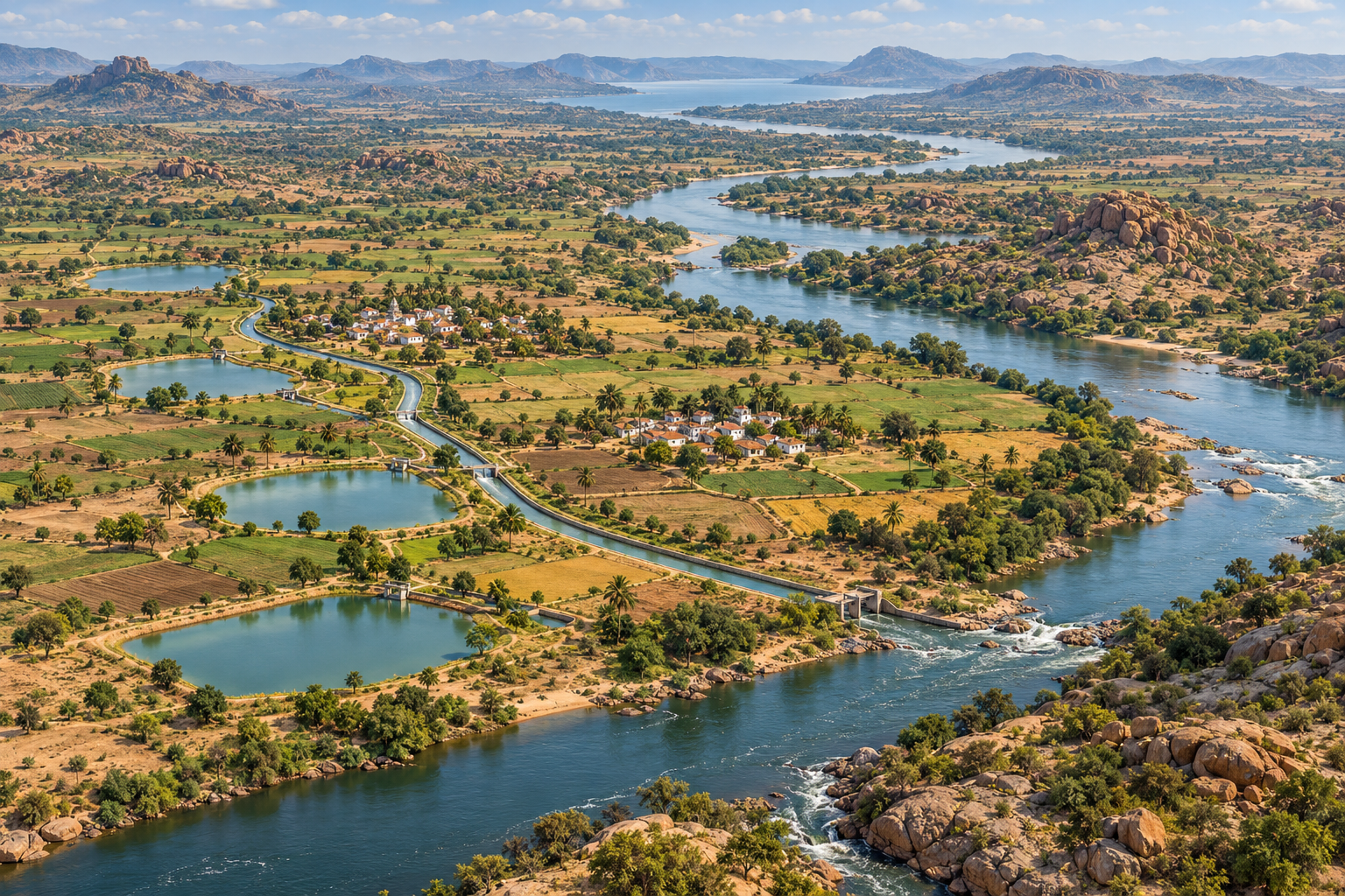
A full river during the monsoon and a dry field a few months later can exist in the same district. For a farmer watching that contrast, the question is obvious: why can’t some water reach the village tank and remain available when a crop needs it?
My proposal is to examine more managed branch channels around suitable villages: fill existing kere and irrigation tanks, supply farms under a published schedule, and return available surplus to the main river. Tungabhadra Dam near Hospet, also called Hosapete, is a useful starting point for this discussion. This is a proposal for investigation, not an approved route or a promise of extra water.
There are already canals. The question is who receives dependable water.
The Tungabhadra Board’s irrigation description identifies an existing system of left-bank and right-bank canals, with responsibilities shared between the Board and state irrigation authorities. It also describes daily reservoir reporting and ten-day canal drawal accounts. The river is therefore not the only existing route for distributing project water.
A new proposal should start by mapping that network. Is a village outside its service area? Is an outlet damaged? Does water reach the head of a canal but not its tail? Would repairing a connection deliver more benefit than excavating another channel? A nearby reservoir alone does not answer these questions.
The observation that some farmers harvest only once a year deserves a village-level survey. It should not become a claim that all farmers across northern and central Karnataka have the same cropping pattern or the same reason for leaving land fallow.
Flood water and reliable irrigation are different
A short flood peak is a large volume arriving at a difficult time. Irrigation is a smaller, controlled supply needed at particular stages of a crop. Turning one into the other requires suitable storage, safe conveyance, operating rules and water that can legally be allocated.
The Board describes flood-release alerts to downstream authorities. Village canals should not be presented as substitutes for flood management: a small canal cannot safely accept an unrestricted flood. Engineers would need to assess inlet controls, channel capacity, crossings, emergency closure and protected overflow routes.
Planning should test dry years as well as wet ones. A second crop based on an unreliable promise may increase a household’s debt instead of its security. The public offer should state how often a supply is expected to be available, when it may be reduced, and what happens during scarcity.
How a village-tank network could work
- Survey before drawing routes: identify tank condition, catchments, land levels, existing rights, drainage paths and villages with unmet need.
- Compare alternatives: repair existing channels and tanks, improve scheduling, or use a new connection only where it adds justified benefits.
- Use a controlled inlet: supply a branch through an authorised, measured offtake with a defined operating schedule.
- Connect suitable tanks: provide gated deliveries, safe overflow arrangements and a clear limit on seasonal storage and withdrawals.
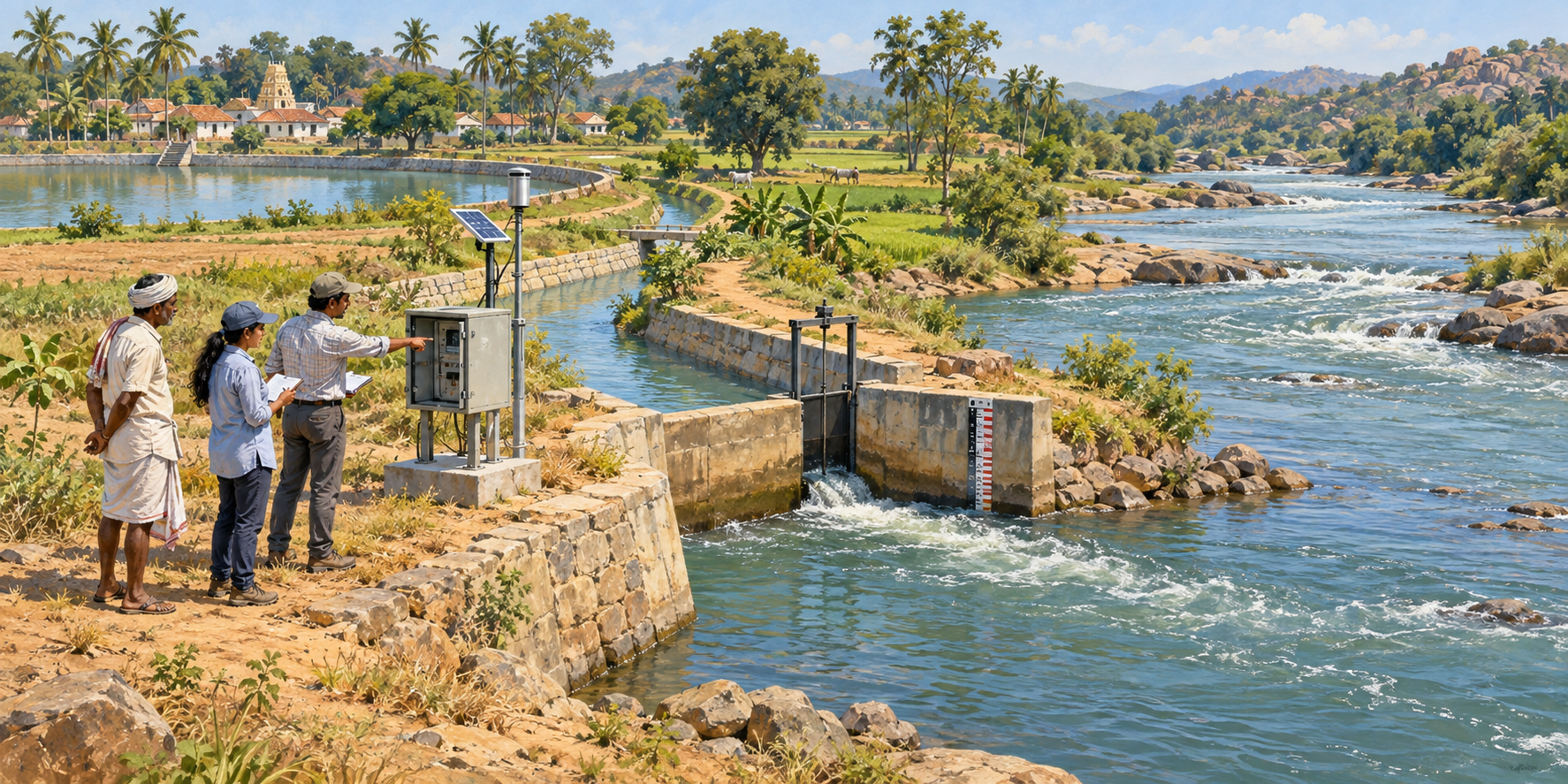
- Measure any return: monitor the branch outlet and the main river at agreed locations, while separately recording use and storage.
These would be managed canals or distributaries—what we might informally call human-made sub-rivers. They need not flow all year. Gravity routes depend on land levels; lifting water over higher ground adds energy, equipment and recurring costs. Routes also require lawful land access and environmental assessment. A line on an attractive map is not yet a feasible canal.
Returning some water does not return all the water
FAO’s irrigation water-balance explanation distinguishes consumption, storage and return flows. Crops use water through evapotranspiration; some water evaporates from surfaces, some remains stored, and some may return later. Counting repeated use inside a system as new incoming water would double-count it.
For a deliberately simplified example, suppose a branch receives 100 units during one accounting period, with no other inflows or unlisted outflows:
| Where the water goes | Illustrative units |
|---|---|
| Measured return to the river | 40 |
| Crop evapotranspiration | 25 |
| Other evaporation | 5 |
| Increase in tank storage | 20 |
| Net increase in groundwater storage | 10 |
These are invented teaching numbers, not measurements or design estimates. Only 40 units have returned within this example’s period. Later releases would belong in later accounts. In reality rainfall, groundwater movement, other withdrawals and measurement uncertainty complicate the balance.
A public audit must respect downstream entitlements
FAO distinguishes water accounting from the wider legal and institutional audit. That distinction matters here: measuring water does not itself authorise diverting it.
The proposal should require the responsible authorities to establish permitted withdrawals, operating conditions, recognised measurement points and the applicable interstate accounting rules before construction. A meter at one canal’s return junction cannot, by itself, certify that another state received its entitlement. Main-river flows, timing and the accepted accounting boundary also matter.
TMC is a volume: one thousand million cubic feet. Cusecs measure flow per second. A dashboard must integrate flow over time, publish calibration and gaps, and distinguish measured figures from estimates. It should show seasonal totals and uncertainty rather than a precise-looking number without an audit trail.
Water stored in a Karnataka tank can be valuable, but cannot simultaneously be described as already delivered downstream. Protecting local farms and honouring downstream rights must be parts of the same plan.
Groundwater benefits need evidence, too
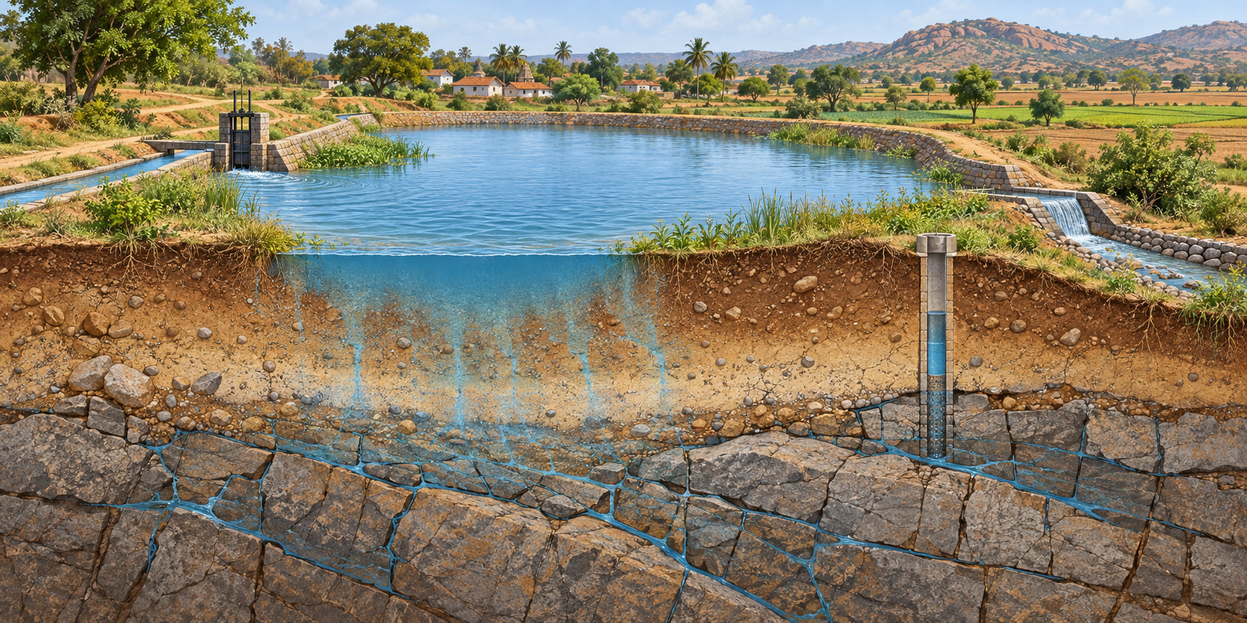
The Central Ground Water Board’s recharge guidance stresses that projects are site-specific and depend on local hydrology and geology. A tank may support recharge where conditions are suitable; filling it does not guarantee that every nearby borewell will improve.
My proposed pilot would record groundwater levels and quality before and after operation, inspect drainage and watch for waterlogging or salinity. It would also agree limits on additional pumping. Otherwise a temporary rise in availability could encourage withdrawals that erase the benefit.
Separate efficient water delivery from deliberate recharge. Some reaches may need protection against unwanted leakage; suitable tank beds or designated areas may serve a recharge objective. Engineers should choose and explain the approach for each location rather than promising that all seepage is either waste or a benefit.
Start with a few tanks and publish the results
Choose a small, technically suitable cluster after consultation with farmers, tank users and affected landholders. Compare it with repairing the existing system, and publish capital costs, annual maintenance, pumping costs where relevant, and expected benefits under different rainfall conditions.
Agree access for tail-end farmers, tenants and small holdings; a connection captured by the largest pumps would miss the purpose. Name the office responsible for gates, desilting, inspections, complaints and payment of operating costs. Provide understandable village noticeboards as well as online records.
The scorecard should include delivery reliability, tank levels, groundwater observations, cultivated area, net farm returns, downstream compliance and maintenance failures. Report disappointing results too. A successful pilot would justify carefully designed expansion; an unsuccessful one should lead to correction before further spending.
Build a service that lasts beyond the inauguration
Bringing dependable water closer to villages is a worthwhile ambition. Its strongest form is a maintained, fairly managed network built around an honest water budget.
The question is not simply how many channels Karnataka can dig. It is how many farm households can gain reliable water without shifting an unaccounted shortage to somebody else. That is the standard by which this proposal should be judged.